
Weathering The Storm: From the Aftermath to the Path Forward, A Three-Point Solution
News
Home / News
Weathering The Storm: From the Aftermath to the Path Forward, A Three-Point Solution
Purpose
Maphlix hopes its experience can help improve agricultural resilience in Ghana by inviting a holistic approach. We hope investors are better informed about the risks in agricultural production in Ghana, act in good faith, and place a premium on resilience. We wish policymakers to continue enabling the environment with public investments in weather forecasting and insurance mechanisms that provide a safety net for farmers and workers that drive Ghana’s agricultural development. And lastly, we deeply thank our partners for supporting us through our most challenging time.
The Destruction
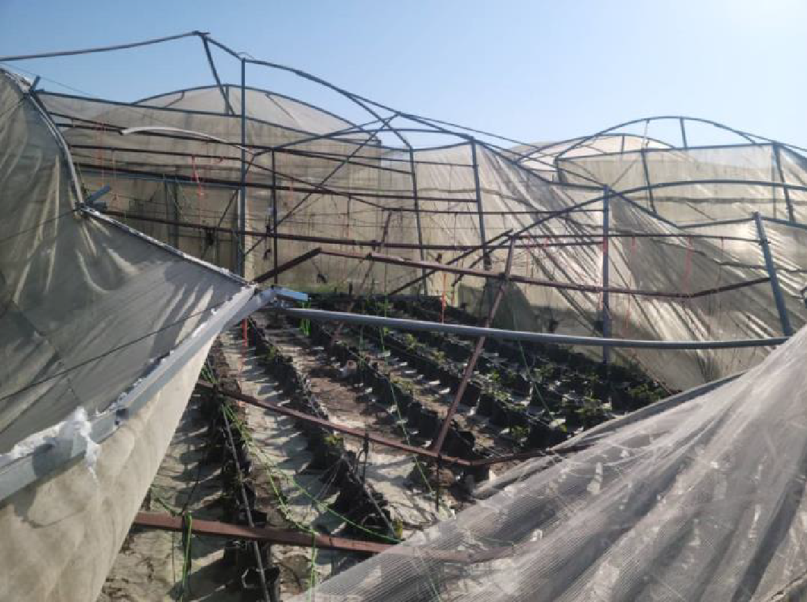
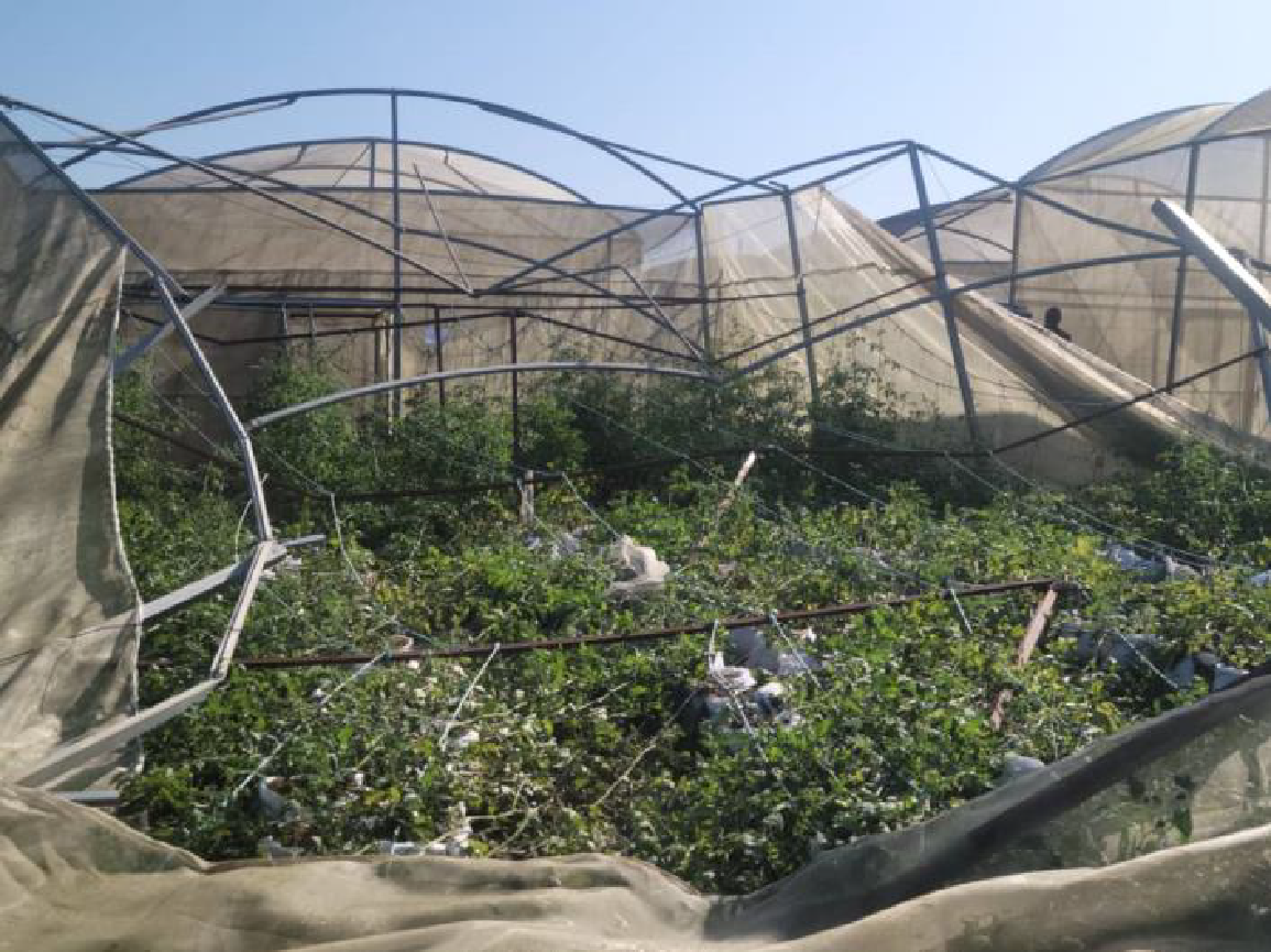
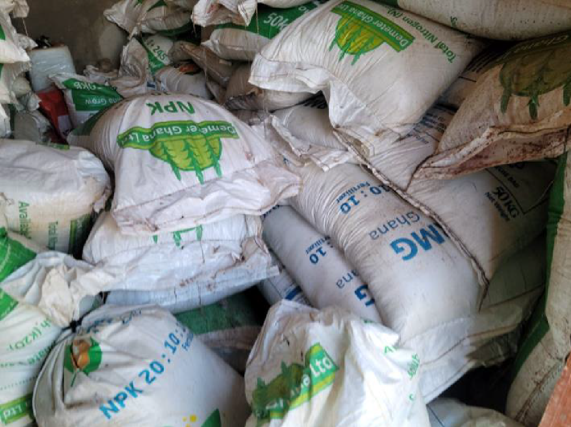
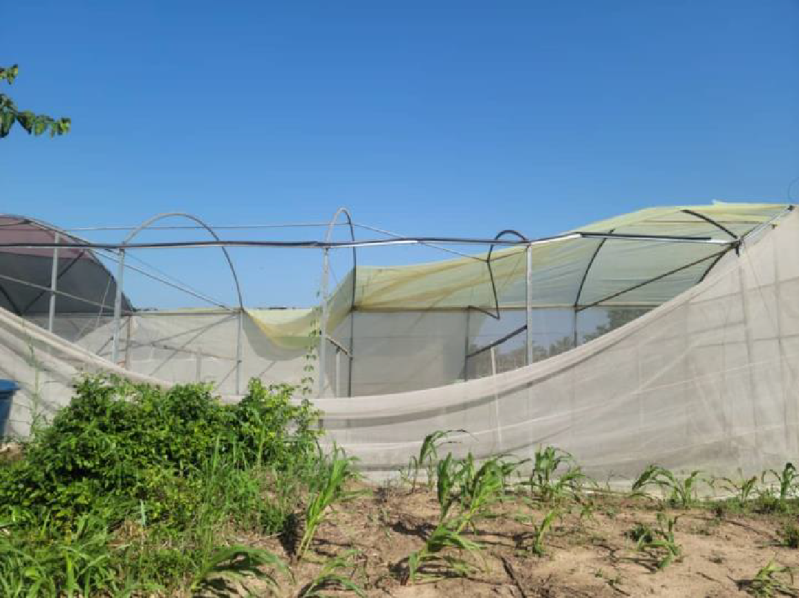
In the pre-dawn hours of May 25, 2024, a West African squall line hit Greater Lomé in Togo. By dawn, the squall line entered Ghana in the southern Volta Region and ripped across Ketu North Municipality approximately 28 km from Lomé. Lomé sits at 1.22°E, and Tadzewu in Ketu North Municipality is 0.97°E; both were in the storm’s path. By mid-morning on May 25th, the extent of destruction became clear. Togolese press reported floods in twenty-two localities and six retention basins across Greater Lomé, with Golfe 5, Golfe 7, and Agoè-Nyivé 4 as the worst-hit communes. Across Ketu North Municipality, roofs were ripped off buildings and houses, and the Agortor River overflowed and flooded the community and farming areas that it supported. Maphlix built its modern farming operations around the Agortor River in Tadzewu, investing over US$324,000 in 27 greenhouses, 55 acres of cultivation, irrigation systems, and various farm equipment including a tractor. Years of investment, with estimated US$ 198,244.361 in 2024 sales from crops that took months of preparation, labour, inputs and working capital, were lost in less than two hours. Ghana News Agency estimated US$588,598.35 in a situational assessment. Citi Newsroom reported that the storm destroyed over US$1,500,000 in investments.
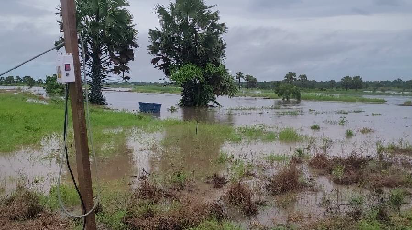
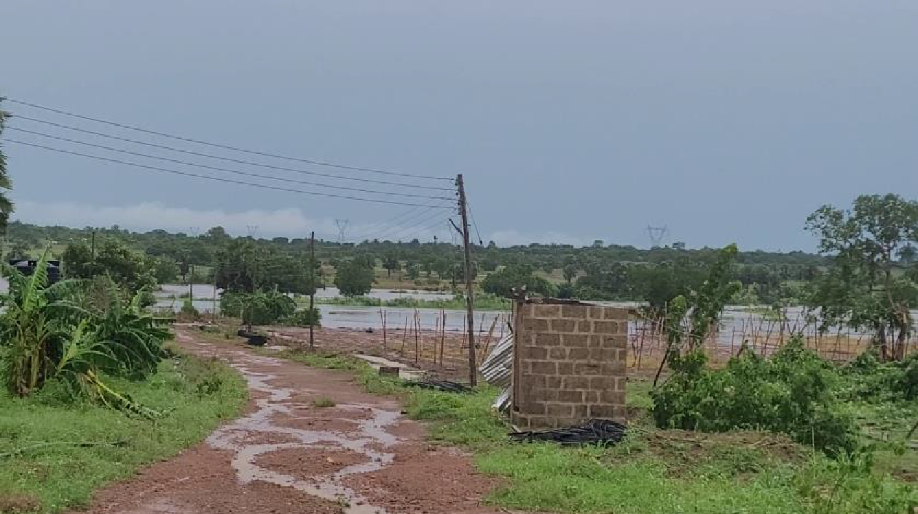

What is a West African Squall Line:
A West African squall line is a self-propagating line of thunderstorms known for its frequency, size, and rapid onset. Advancing at 40–70 km/h, it can extend for several hundred kilometers and persist over twelve hours. It spreads west overnight and typically crosses southeastern Ghana before dawn, arriving as violent straight-line winds followed by torrential rain. Unlike an ordinary thunderstorm that dies in under an hour, it ignites new thunderstorms along its western front for hours, causing damage across entire districts along the coastal storm corridor.
Formation:
The heat contrast between the Sahara and the Gulf of Guinea creates the African Easterly Jet, a band of east-to-west wind 3–4 km up that in May runs along the 9–10°N latitude of Tamale. The edges of the jet lag its core, generating the African Easterly Waves, which cross West Africa every three to five days and provide the broad lift that primes convection.
Between April and October, beneath the jet, in the lowest 2 km of the atmosphere, the southwest monsoon pushes moist air northeast from the Gulf of Guinea toward elevated terrain (e.g., the Atakora Range, Jos Plateau, and Cameroon Highlands), where the first thunderstorm starts in the afternoon. Ground heat from the slopes and the lift from the African Easterly Waves force the moisture up through the hot, dry Saharan air mass above to condense into rain. The rain partially evaporates in the Saharan air mass, sharply chilling the surrounding air, which then plunges violently 3–5 km to the ground, gusting outward like a miniature cold front. In its rush, it heaves up the warm, moist air ahead of it, repeating the cycle along the western front to create a squall line. The African Easterly Jet drives the squall line westward while the southwest monsoon strengthens at night and stokes it from below.
Was There An Early Warning System?
An early warning system for the storm corridor is possible, but understanding the mechanics, dynamics, and timing of the squall line could vastly improve its effectiveness. A squall line forming its first storm in the afternoon could generate real-time warning and give 10-12 hours for people and operators in Ghana to prepare. Daily Graphic reported the capacity of Ghana Meteorological Agency (“GMet”) to issue a warning three weeks earlier, on 6 May 2024: GMet observed a rainstorm over southern Togo, forecasted its "drift westward" into southern Ghana, issued a warning at 5:30AM and identified Aflao, Keta, Dzodze (10 km from Tadzewu), Anloga, Ho, Ada Foah, Tema and Accra as high-risk areas between 6:45–11AM. However, GMet issued the warning at 5:30AM, leaving no time for preparation. The storm tore roofing off 7 SHSs and 18 basic schools in Ketu North Municipality. Villagers in the municipality asked if an early warning was issued or not on Friday/Saturday of 24–25 May, and if not, why the mechanism that worked on Tuesday May 7th didn't run that night? Did the weekend play a factor?
The Impact
As a horticulture export company and registered Free Zone enterprise, Maphlix is a mission-critical player in the Volta Region, leveraging its end-to-end operations to shift subsistence and opportunistic farmers in the local communities to commercial growers with higher income. It connects farmers, input suppliers, micro-processors, transporters, service providers, and buyers into an effective agricultural ecosystem that develops the rural economy, creates jobs, promotes sustainability, and diversifies national exports via horticulture.
The May 2024 storm followed five consecutive years of external shocks and volatility to Maphlix’s operations. COVID-19 scrambled operations and increased costs from 2019-2021. Air cargo capacity collapsed and hit perishable exports, spiking rates from 2020–2022. Container shortages and port congestion delayed shipments in 2021. In 2022, the cedi lost ~50% of its value, causing double-digit inflation, spiking bank rates, and precipitating Ghana to default by December. From November 2023 to January 2024, Red Sea crisis drove sea freight up 130%.
Then, the May 25th storm in 2024 destroyed the Company’s productive assets. Citi Newsroom reported Maphlix employing over 200 workers with over 150 youths at risk of job loss. Production halted, export commitments were unmet, and capital to meet debt service and day-to-day operations became scarce. Outgrowers lost access to inputs, technical support, and mechanization, impacting their production and rebuilding. After five years of navigating volatility and external shocks, Maphlix estimates the destruction of its Tadzewu Farm to have set it and the rural economy of Ketu North Municipal back by more than two years.
The Lessons
“We cannot control every storm. But we can strengthen our preparedness, infrastructure, risk management, and response.”
The 2024 event highlights three lessons:
Lesson One: We Need An Effective Early Warning System
An effective early warning system and weather forecasting models tailored to West Africa can serve as the foundation for agricultural resilience. Since weather knows no boundaries, ECOWAS-level cooperation may be required for its development. Public investment in such a system generates social and economic returns. An early warning system would allow people and businesses to plan and prepare up to 12 hours before the storm’s arrival at dawn. It would also provide reliable data for insurers and investors, policymakers, and business operators to structure risk-mitigating tools and enhance investment planning for agricultural development.
Lesson Two: Agricultural Insurance Market Requires Fair Pricing
Reliable weather data can make agricultural insurance pricing transparent, fair, and data-driven. The National Insurance Commission (“NIC”) in Ghana recognises agricultural insurance as integral in the market, with Agricultural Insurance Fund supporting insurance against production risks related to drought, flood, and pests. However, for the private sector to drive the growth of the agricultural insurance market, reliable weather data is required to make insurance pricing transparent, fair, and data-driven. Unreliable weather data makes insurance pricing difficult. Low pricing invites moral hazard and perverse incentives that may precipitate a loss for the insurer, causing them to pull from the market. High prices may dissuade business operators with limited access to weather data from finding value in insurance coverage. In early 2024, Maphlix faced no insurance company to insure the Tadzewu operations. This painful experience motivates Maphlix to continuously engage with NIC in creating a fair and affordable insurance market that mutually protects farmers, agribusinesses, and insurers.
Lesson Three: Weather-Linked Force Majeure Clauses Are Required
Building Ghana’s agricultural sector requires investments with terms and conditions tailored to local conditions. Foreign impact investors who are committed to positive “impact” should work in good faith with agricultural business operators to effectively manage risks, tailor terms and conditions that reward resilience, and align on long-term gain. Force majeure clauses are integral in Western legal contracts, and impact investors in West African businesses should make it likewise. Destruction of productive assets impacts cash flows and puts jobs, farmers' incomes, and international supply chains at stake. “Impact” investors should avoid leveraging asymmetric information for their extractive benefit and instead focus on technical support in the following:
- Comprehensive risk management from insurance to business diversification and governance
- Flood-risk mapping and capex to protect infrastructure (e.g., irrigation, drainage, packhouse, sheds) that allow for faster recovery
- Contingency planning involving working capital and force majeure clauses to surmount short-term business interruptions and promote recovery and resilience in the medium-term
- Supportive managerial co-creative discussions to provide balance sheet flexibility and orient for growth
- Repayment schedules aligned to actual cash flows, long-term growth, and external realities while ensuring just compensation for investors
The Road To Recovery: Allies & All-Weather Friends
Despite having withstood the external shocks since 2019, the 2024 disaster became a severe existential crisis for Maphlix. However, the disaster yielded the greatest insight of all: the belief of farmers, workers, and stakeholder partners in Maphlix and their commitment to help rebuild Maphlix stronger than before. The storm’s adverse impact on food security, rural livelihoods, and agricultural development in Ketu North attracted attention from key government institutions and industry partners, underscoring agricultural disasters as national development issues. Maphlix continues to rebuild its financials and operations. It remains even more committed to working with its farmers, government institutions, development partners, investors, and insurers for a stronger inclusive agricultural value chain.
Support from partners allowed Maphlix to slowly replant, reconnect with buyers, diversify operations, and de-risk with agricultural insurance.
Media Coverage Links
Ghana News Agency “Ketu North: Maphlix Trust Farms engulfed by storms fury, causing huge losses”
Citi Newsroom “Ketu North: Devastating rainstorm damages major farm, threatens over 150 jobs”
GBC News “Rainstorm destroys properties and food crops at Tadzewu”
Myjoyonline “Ketu North rainstorm: Urgently offer support to affected Maphlix Farm”
Download Report: Download The 2024 Maphlix Farm Incident Report
Support from partners allowed Maphlix to slowly replant, reconnect with buyers, diversify operations, and de-risk with agricultural insurance.